Multi-Radar Multi-Sensor for Aviation
MRMS ingests radar, satellite, lightning, upper-air and surface observations, and numerical model output to create a three-dimensional depiction of real-time weather.

MRMS ingests radar, satellite, lightning, upper-air and surface observations, and numerical model output to create a three-dimensional depiction of real-time weather.
MRMS is a processing system that ingests radar, satellite, lightning, upper-air and surface observations, and numerical model output to create a three-dimensional depiction of the present weather.
MRMS has three product suites: Hydrological, Severe, and Aviation. The types of products range from quantitative precipitation estimates, to mesocyclone rotation tracking algorithms, to flight hazard detection.
The FAA Aviation Weather Research Program (AWRP) sponsored the first prototype version of MRMS at the William J. Hughes Technical Center in Atlantic City. This paved the way for the adoption of MRMS by the National Weather Service, who now manages the operational MRMS system.
FAA funding has also allowed for the development of novel techniques to quality control radar data used by MRMS. This improves not only the accuracy of the aviation products, but all products generated by MRMS. The AWRP/NSSL/NWS collaboration is a close working relationship that allows for the rapid transition of radar applications into operations, thus leading to increased safety and enhanced efficiency of flight.
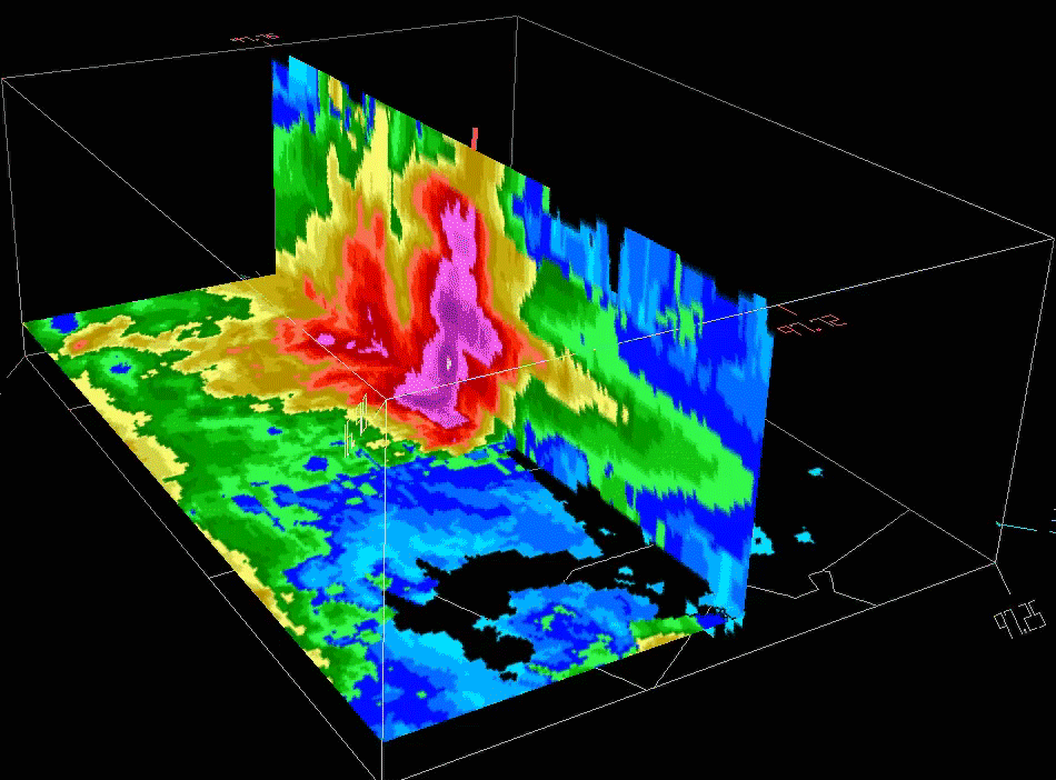
MRMS provides three-dimensional mosaics of radar reflectivity. The domain extends from the surface to about 62,000 ft above sea level and has a 1-km grid spacing. Over 100 products are generated from the mosaic every 2 min.